Introduction
Link: https://gralhix.com/list-of-osint-exercises/osint-exercise-002/
Difficulty:
For beginners: a) Easy, b) Hard
For experts: a) Easy, b) Medium
Briefing:
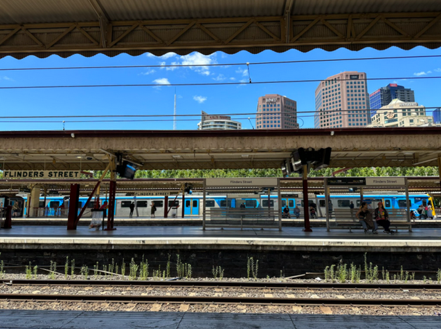
The photo below was shared on social media. It clearly depicts a train station.
Please answer the following questions:

a) What is the name of the train station seen in the photo?
b) What is the name and height of the tallest structure seen in the photo?

Click [here](https://gralhix.files.wordpress.com/2023/01/osintexercise002-4.png) to open the photo on a new page.Solution
Before jumping on Google, let’s enumerate what we see in the picture:
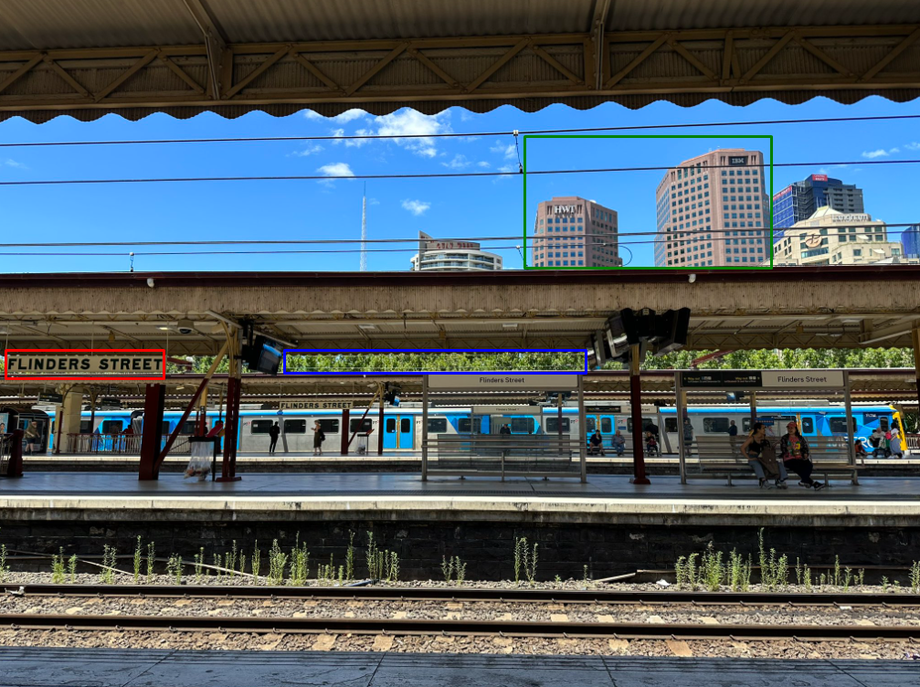
The first element that seems to be relevant is the name on the left (red). It looks like a station’s name.
On the back there are several buildings. The most recognizable ones are the two brown buildings (green).
Finally some trees are present between the docks and the buildings (blue).
If we look at the name on Google:
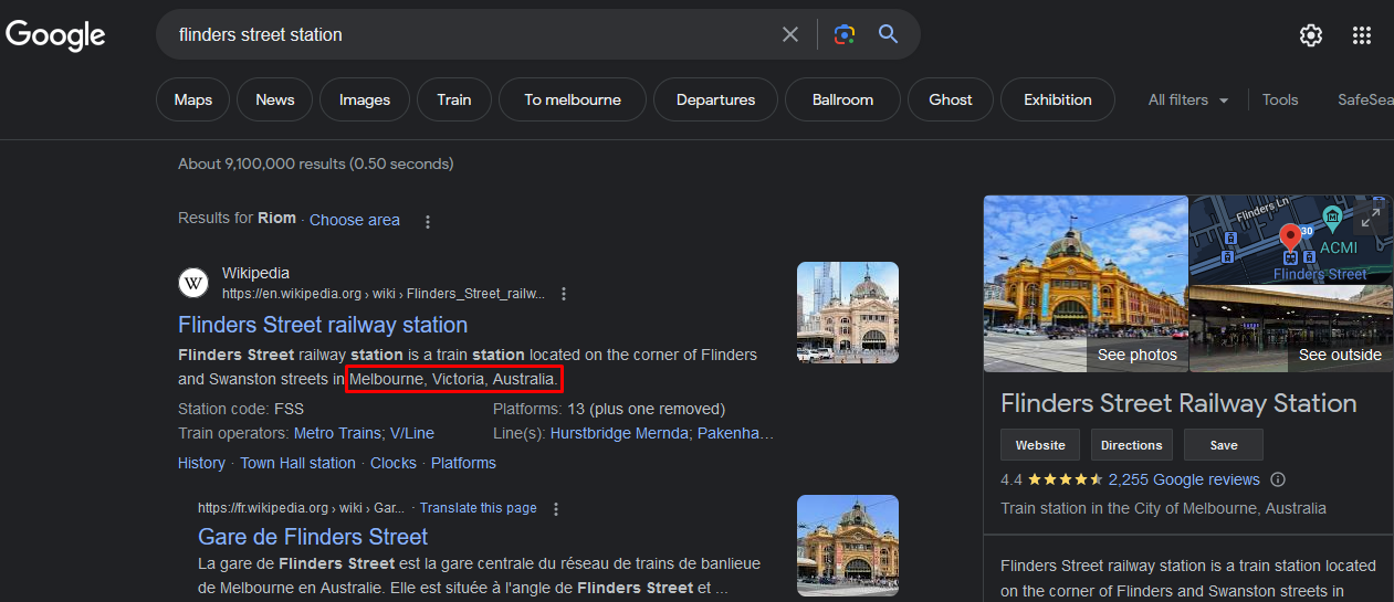
As predicted, this is a railway station located in Melbourne, Victoria, Australia.
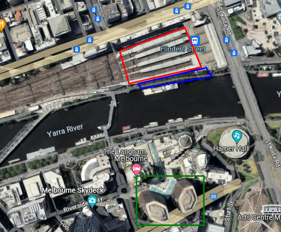
A quick view on Google Maps and we identify the three elements we hilighted previously:
If we want to have fun, it is also possible to determine on which dock the photo has been taken. And as we are funny guys, let’s find it 🙂
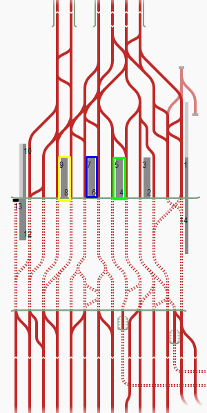
On the Wikipedia’s railway station page, there is a template showing all the docks and their number:
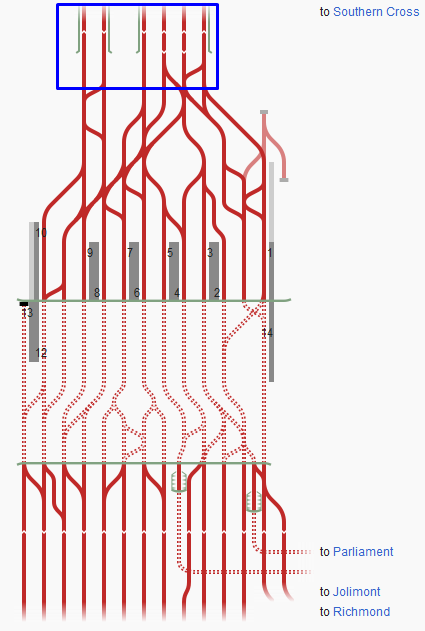
https://en.wikipedia.org/wiki/Template:Flinders_Street_railway_station
But we must determine where to look at because the template is not in the same direction.
To help us, there are six rails coming from the top (blue). We can also find them on the map:
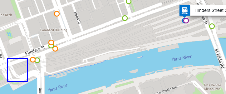
https://www.ptv.vic.gov.au/stop/1071/flinders-street-station/0/train/#StopPage:::datetime=2023-07-05T06%3A02%3A11.132Z&directionId=-1&showAllDay=false&_auth=4bc5b4eb633af0adb376439b149337c4f29dfc76c21e642605600f51ee15e08d
Another way would have been to look at the directions at the bottom of the template.
Example if we want to go to Parliament Station:
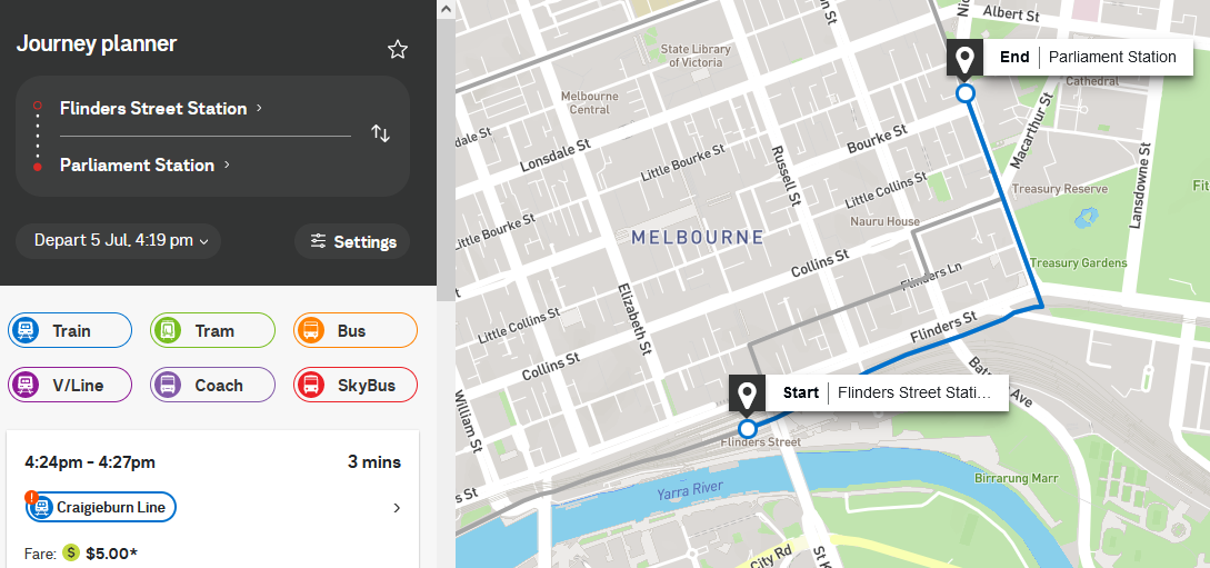
We can conclude that the dock near the river is the last one (number 13).
On the photo, at least three docks are identified (green, blue and yellow), and there is another one behind the train because as we seen on the map, there is a last one dock near the river:
![[002_station_docks.png]]
The photo seems to have been taken from the dock number 5.
This step wasn’t necessary at all but I found it funny to explain.
Let’s get back on our main mission: finding the height of the black building we see in the photo.
By using street map to get a better view, we can identify some buildings but oddly, we can’t find the builsing we are looking for:
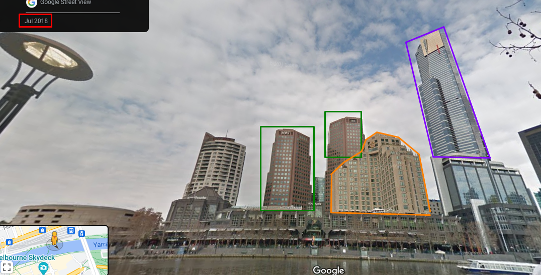
https://www.google.com/maps/@-37.8191404,144.9656248,3a,75y,175.53h,106.62t/data=!3m6!1e1!3m4!1sxb-q5jP4TsW3Qf14hQJhIg!2e0!7i13312!8i6656?entry=ttu
This means the building was built after Jul 2018. Unfortunately, we can’t change the timeframe to a more recent date.
It is a dark building with red panels. I decided to use Google Street Map to look around the location and find a building that could correspond:
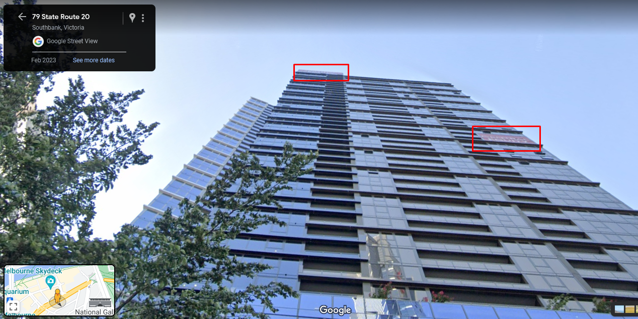
This one is a good candidate as we can see. and the street view is dated on Feb 2023.
The building’s name is "Focus" and is located at 81 State Route 20 (as indicated on the facade). It is managed by the company "Central Equity":
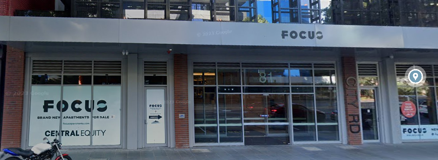
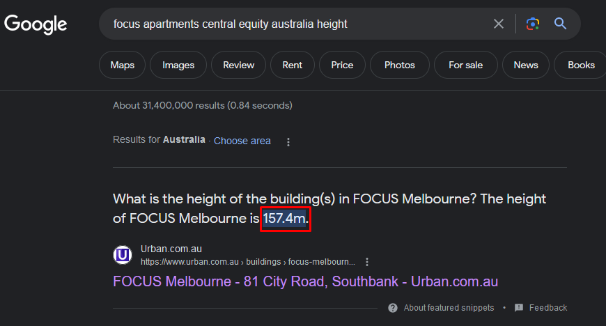
A quick search on Google and we find the height:
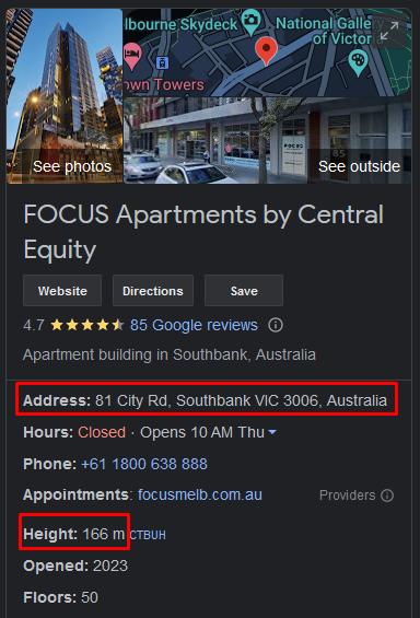
But let’s try to find another source of data to double check and validate the height.
From https://www.multiplex.global/news/multiplex-delivers-focus-to-skyline-with-new-melbourne-tower/:

From https://en.wikipedia.org/wiki/List_of_tallest_buildings_in_Melbourne:

With Wikipedia, we learn that the construction started in 2020 but was paused until 2022.
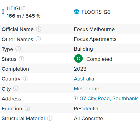
From the Wikipedia sources (https://en.wikipedia.org/wiki/List_of_tallest_buildings_in_Melbourne#cite_note-FocusMelbourneCTBUH-166):
The building was completed in 2023, that why we didn’t see it on Street Map from the Flinders Street station.
Flag
a) Flinders Street
b) FOCUS Apartments – 166 meters

