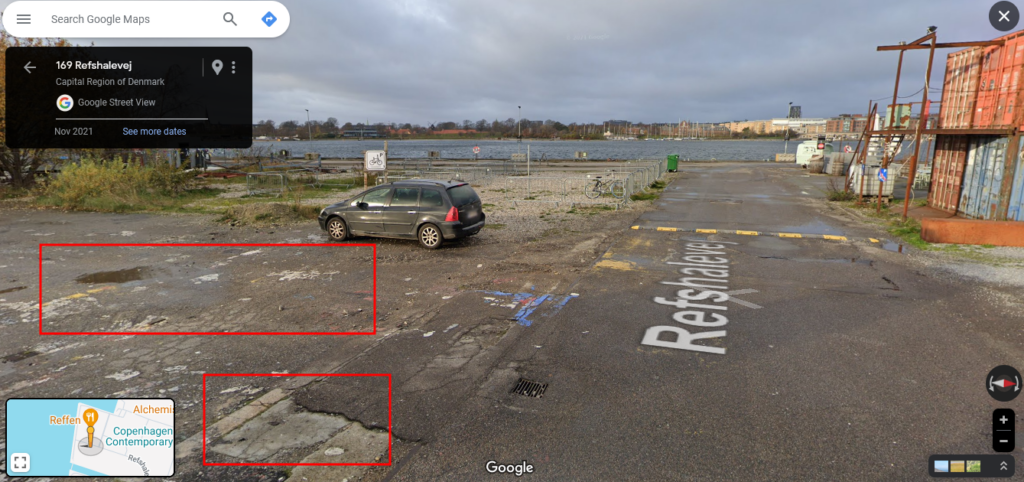
This challenge could seem impossible, but with a specific trick, it is pretty easy to find the location.
To make it a bit more difficult, I wanted to find the exact location (when I say exact, I mean max 1 meter away).
Link to the OSINT challenge video:
https://www.youtube.com/watch?v=B_tL3uYaRqA
I urge you to try by yourself before looking at this solution
Solution
At first, looking the entire video leads nowhere. We can’t identify any landscape, building, car, sound, etc..
The only view we’ll see is this road:
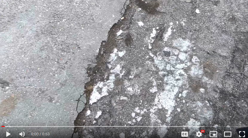
The road is very specific and deteriorated. So a zone where trucks and big engines are passing?
The only other piece of information we have during the entire video is when Cody films its smartphone:
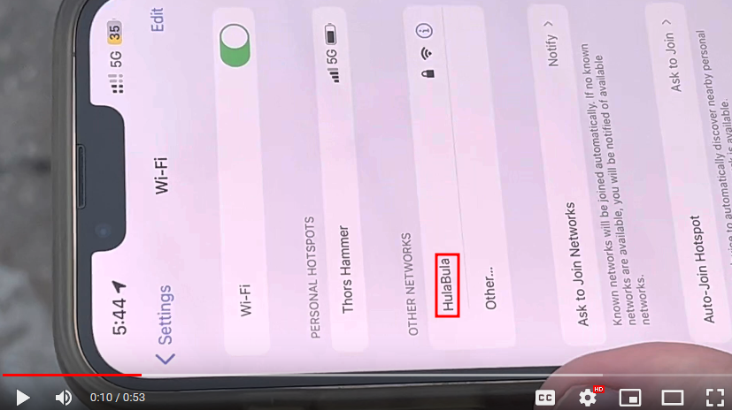
We identify two SSIDs which are the names we give to Wi-Fi networks.
The first one "Thors Hammer" is unusable. Why? Because it is his personnal hotspot running in 5G so we won’t be able to identify it.
But the second one named "HulaBula" is interesting.
If you don’t know, there’s an incredible website called Wigle.net which is a database that stores more than a billion Wi-Fi networks.
How does it work?
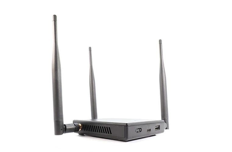
When people are moving in town, going on vacations, etc.. they can run a capture device like the Wi-Fi Pineapple which captures all the SSIDs it finds around you current position.
Then you can upload your data on wigle and let people search for these Wi-Fi names.
This is what we’ll use there.
You must create an account on the website to get the full results but it is completely free.
We search for the SSID "HulaBUla" on wigle:
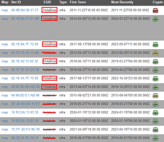
https://wigle.net/search?ssid=HulaBula
As it takes all names without worrying about the case, we must remove all the ones written in lowercase.
Finally it remains only 9 Wi-Fi networks with the name HulaBula.
Six of them are located in Copenhagen and the three others are in Finland and USA.
We’ll start with the ones in Copenhagen.
Wigle allows us to view the SSIDs on a map:
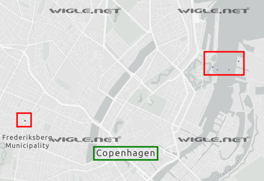
There locations are pretty accurate overall (max 100 meters away).
First, we look at the only point on the left using Google Street View:
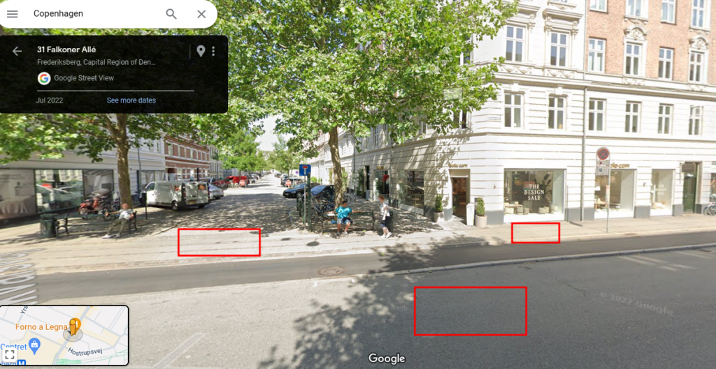
This is not what we are looking for.
Move on the other ones:
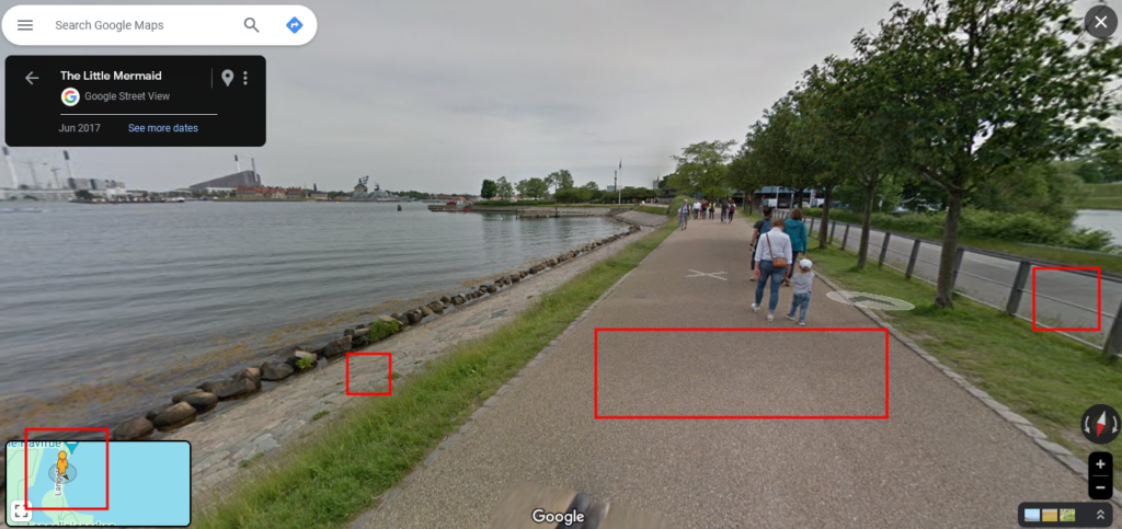
Still not.
Broken road, port area, could match!
There is a brewery called Mikkeller Baghaven so it’s logic to find a SSID here.
At this moment I was sure this was the location we were looking for.
But there’s still something to find: Where exactly?
We only see Cody’s shoes and the ground.
Can we identify unique elements from this?
Then answer is yes!
At the end of the video we see this manhole cover and a yellow paint next to it:
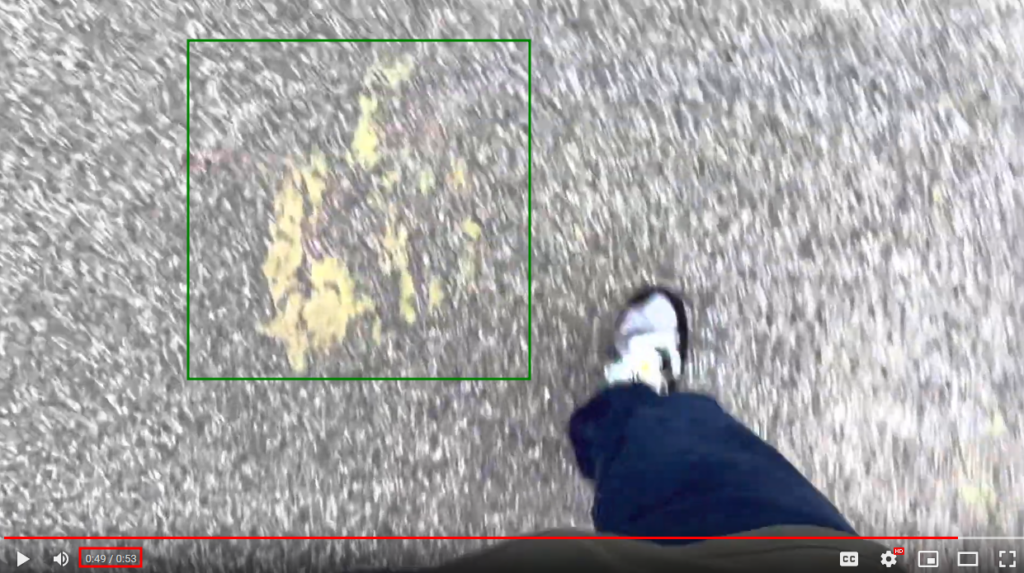
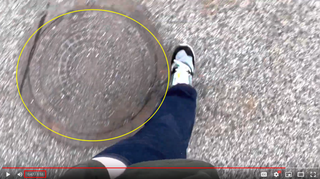
After poking around for some time, I finally found it:
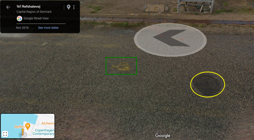
https://www.google.com/maps/@55.6931891,12.6073919,3a,48.8y,279.66h,53.52t/data=!3m6!1e1!3m4!1shM8PPa–H2CT8K8QR43GZw!2e0!7i13312!8i6656?entry=ttu
As you may notice, this is the end of the video. It means we just have to rewind all of it and follow the clues to identify the starting point.
Let’s do it!
There’s a piece of road which is different than before with a few recognizable elements:
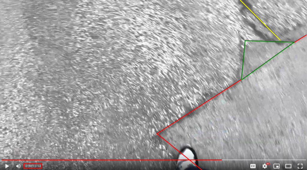
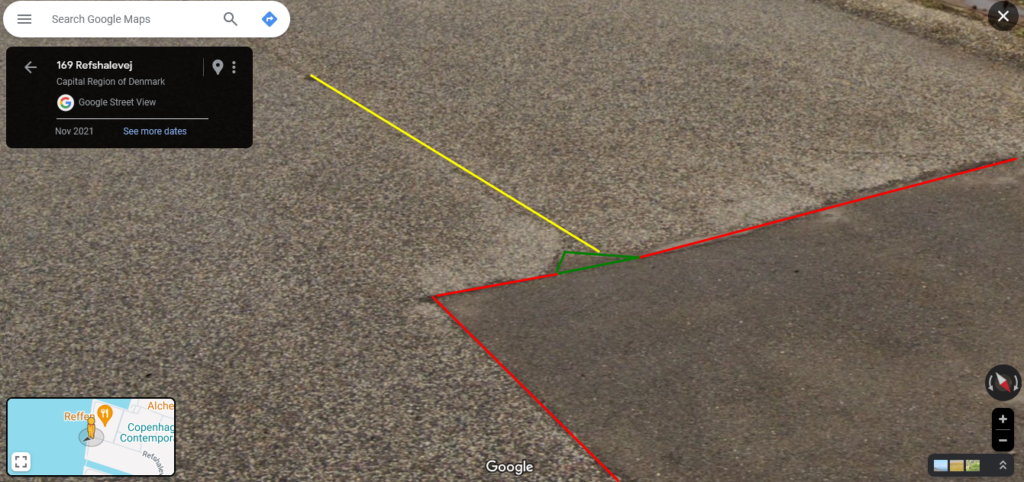
https://www.google.com/maps/@55.693324,12.6074562,3a,17.5y,216.45h,67.78t/data=!3m6!1e1!3m4!1sVDbcs3WrqjYhZB05IgQVTw!2e0!7i16384!8i8192?entry=ttu
Before that, Cody’s walking on rails and there’s a very specific hole in the road:
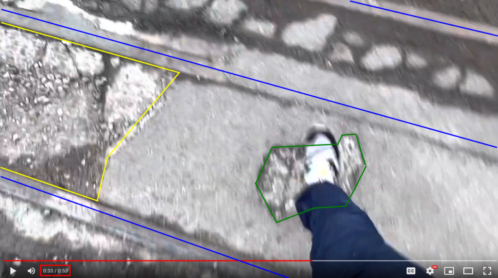
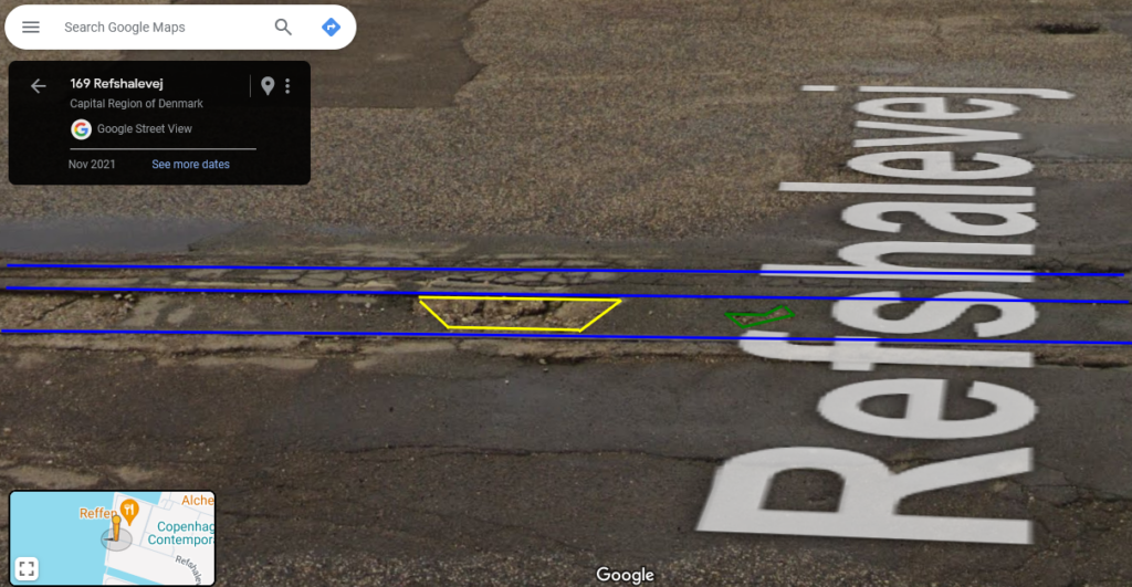
https://www.google.com/maps/@55.6932975,12.6076138,3a,15y,276.24h,73.76t/data=!3m6!1e1!3m4!1scTQ4_8m-7d4VoULIJ2MOnA!2e0!7i16384!8i8192?entry=ttu
Then, I was able to identify these red paint stains:
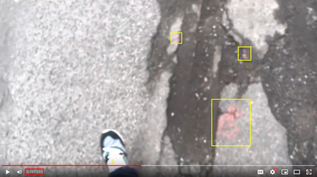
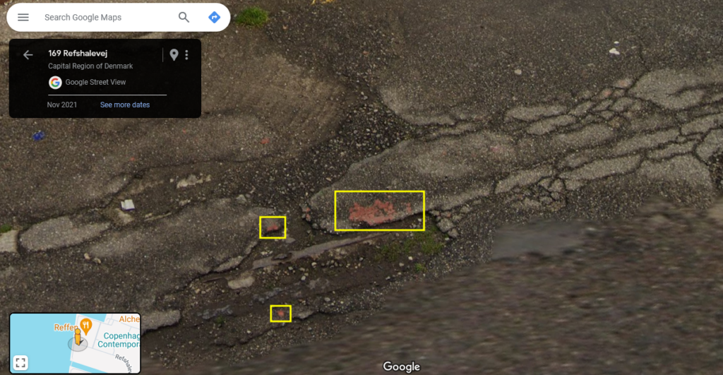
https://www.google.com/maps/@55.6932975,12.6076138,3a,24.9y,36.33h,42.06t/data=!3m6!1e1!3m4!1scTQ4_8m-7d4VoULIJ2MOnA!2e0!7i16384!8i8192?entry=ttu
Don’t worry, we’re almost at the end of our journey!
These four white paint dots are easily recognizable:
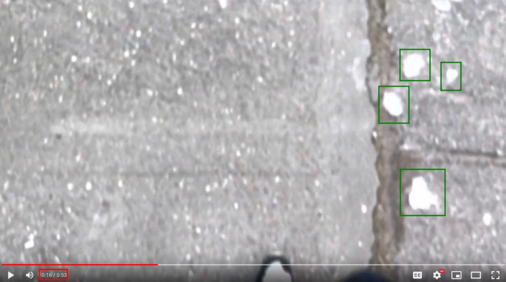
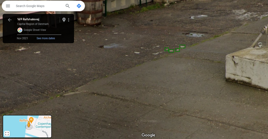
https://www.google.com/maps/@55.6932669,12.6077537,3a,15y,342.03h,73.78t/data=!3m6!1e1!3m4!1sScJuyCUgC6L1HBvOyXurug!2e0!7i16384!8i8192?entry=ttu
As you can see, it is more difficult to follow the path Cody took because of the lack of Street View points.
Eventually, the first image of the video is this one:
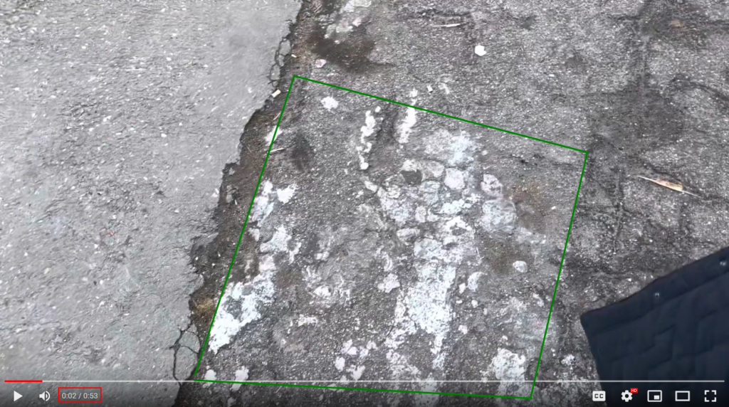
Which can be found here, just in front of the restaurant’s entrance:
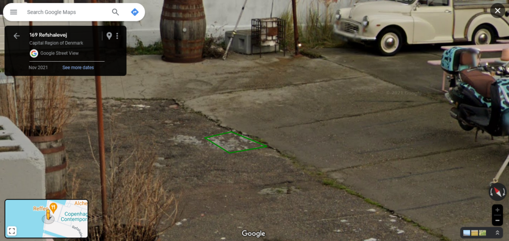
https://www.google.com/maps/@55.6932975,12.6076138,3a,15y,37.49h,79.74t/data=!3m6!1e1!3m4!1scTQ4_8m-7d4VoULIJ2MOnA!2e0!7i16384!8i8192?entry=ttu
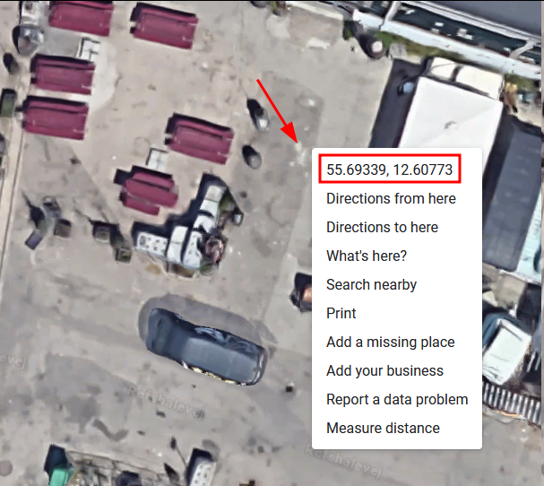
We found the exact location of Cody in this video!
This was fun! I had a very cool time doing all of this investigation.
Hope you enjoyed the writeup and that you learnt some new techniques.
Do not hesitate to contact me if you want to discuss about OSINT/GEOINT or if I made a mistake or missed a crucial piece of information.
Answer
GPS Coordinates: 55.69339435709188, 12.607727208541924

