One of my favourite challenge of this series.
It requires to analyze elements in the video and not just only perform reverse image search (which doesn’t work here).
Link to the OSINT challenge video:
https://www.youtube.com/watch?v=l0OeSW6QifE
I urge you to try by yourself before looking at this solution
Solution
As explained in the excerpt, this challenge cannot be solved using only reverse image search (or if you were able to do it this way, let me now!).
We’ll have to identify all the elements and extract them to create a context and cross all the clues together in order to being able to pinpoint the location where the vide took place.
This first image of this video is this one:
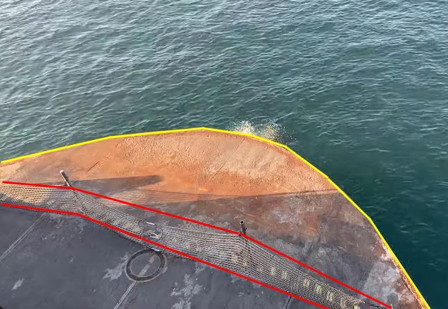
We’re on a boat with a rusted front (yellow) and a barrier made of net (red).
How do you know this is the front and not the back?
Because there’s no trail in the water like this:
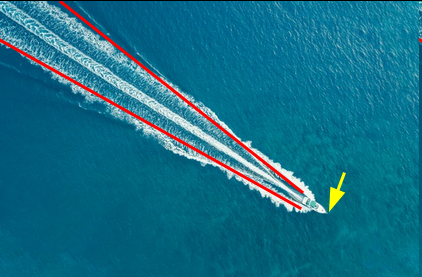
The point of view is from above so, Cody somewhere on the left and elevated.
Keep that aside and continue the video.
The landscape look like this:
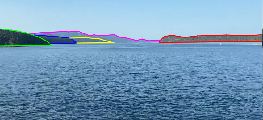
These will be the main elements we are looking for once we identified the main location.
Remember when I bothered you with the famous context for almost every challenge I solved?
I’m sorry but here it comes again 🙂
In all the previous challenges, Cody chose places "near" its home location (around Seattle). This is not a proof that this time it’ll be the same but we can first check this way.
If we search for something like "seattle boat tours":
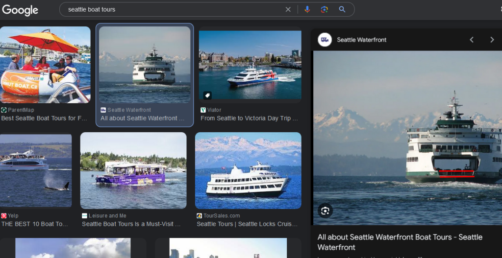
This image could match the boat we are looking for.
Let’s get more information about this boat:
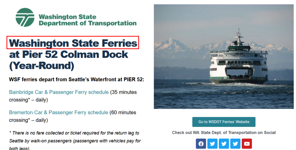
https://seattlewaterfront.org/all-about-seattle-waterfront-boat-tours/
We have a name: Washington State Ferry.
Confirm this information with Google Images:
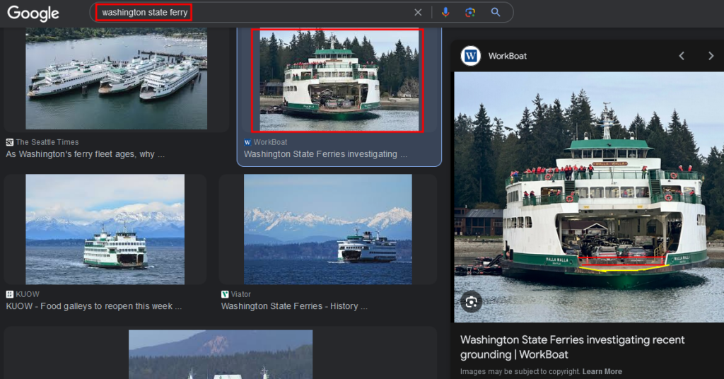
As shown in the image, it seems that the elements are the same (red and yellow).
At this moment we’re pretty sure this is one of these boats Cody is on.
But we can go further this way.
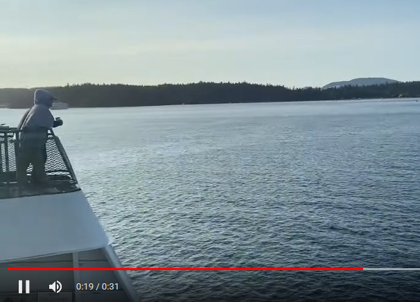
In the video, at 0:19, the camera turns to the left and shows this:
If we search for other views for the ferry on Google Images, this one appears:
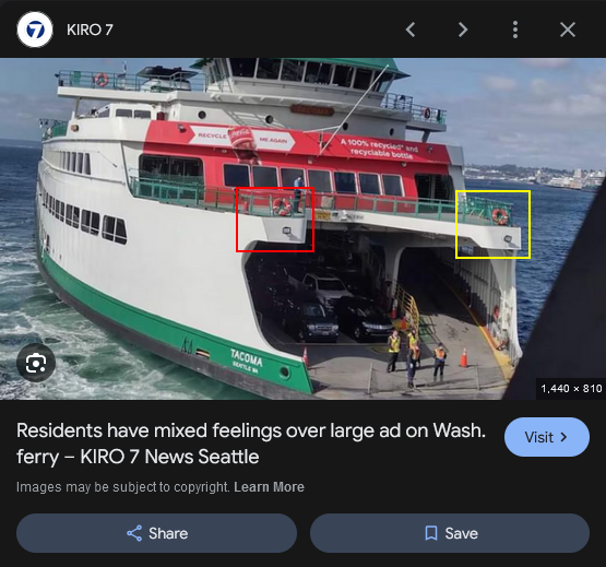
The barriers are green, the hull is white and we see the net at the bottom again.
I wanted to play a bit with Google Street View to check if I could find a view of someone on the boat and I found this:
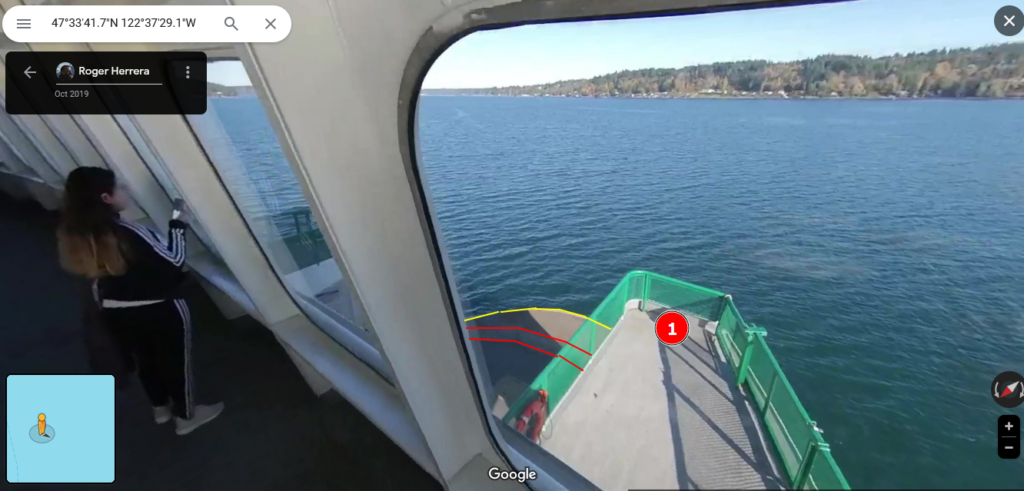
https://www.google.com/maps/@47.554031,-122.6152718,3a,64.8y,131.04h,69.58t/data=!3m7!1e1!3m5!1sAF1QipM_CHwY3Yfc0IWE5LHe9odIRg-dDp2FQNsfKqDZ!2e10!3e11!7i5760!8i2880?entry=ttu
Which is the exact same position from where the video was recorded.
So far, we found the ferry’s name and were able to confirm it was the correct one.
But know we need to find the exact location. We must identify the routes to check them one by one:
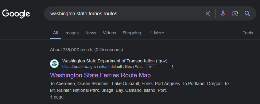
https://wsdot.wa.gov/sites/default/files/2021-04/WashingtonStateFerries-RouteMap.pdf
There are only a few routes next to Seattle:
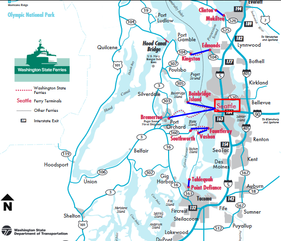
I won’t find all the attempts here because they’re are not useful but I show you how I abandoned this assumption.
If we take a look at a random route. Let’s say from Seattle to Bremerton.
From Google Street View we are lucky to find someone’s pov from a ferry:
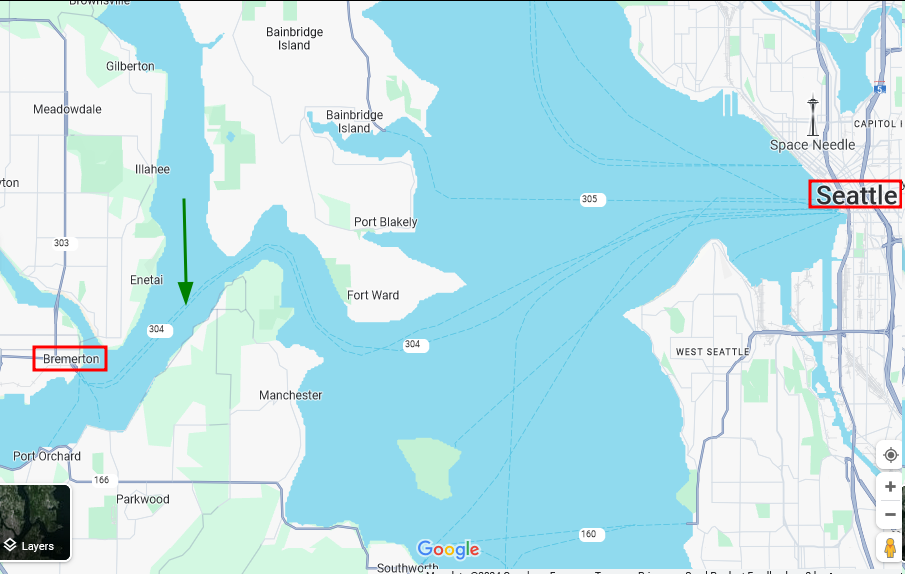
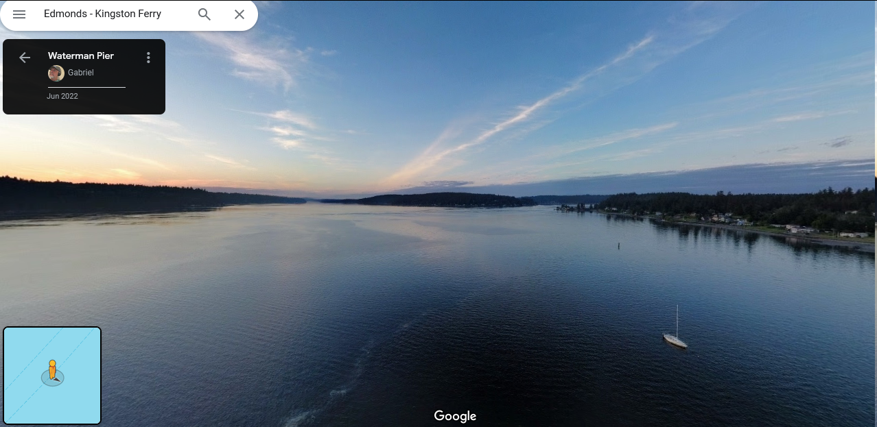
The ambiance seems the same but the landscapes are different because there are no hills/mountains, it is flat.
And it is all the same about the routes around Seattle.
Then I thought it could have videos on Youtube or on the Internet about these ferries’ journeys?
I eventually found this video on Youtube:

This is highly interesting because we are able to see that the landscape is way more hilly than previously.
So maybe drive our researches in this area.
Remember the PDF file in which the routes were detailed?
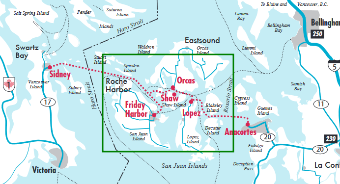
After confirmation, there are also ferries going in this area.
I decided to look for Google Street View points in this zone. I strongly praised to have at least enough to be able to identify the correct landscape and location.
After some long minutes (it took me something like 30 minutes), browser the Street View points, I eventually find this interesting one:
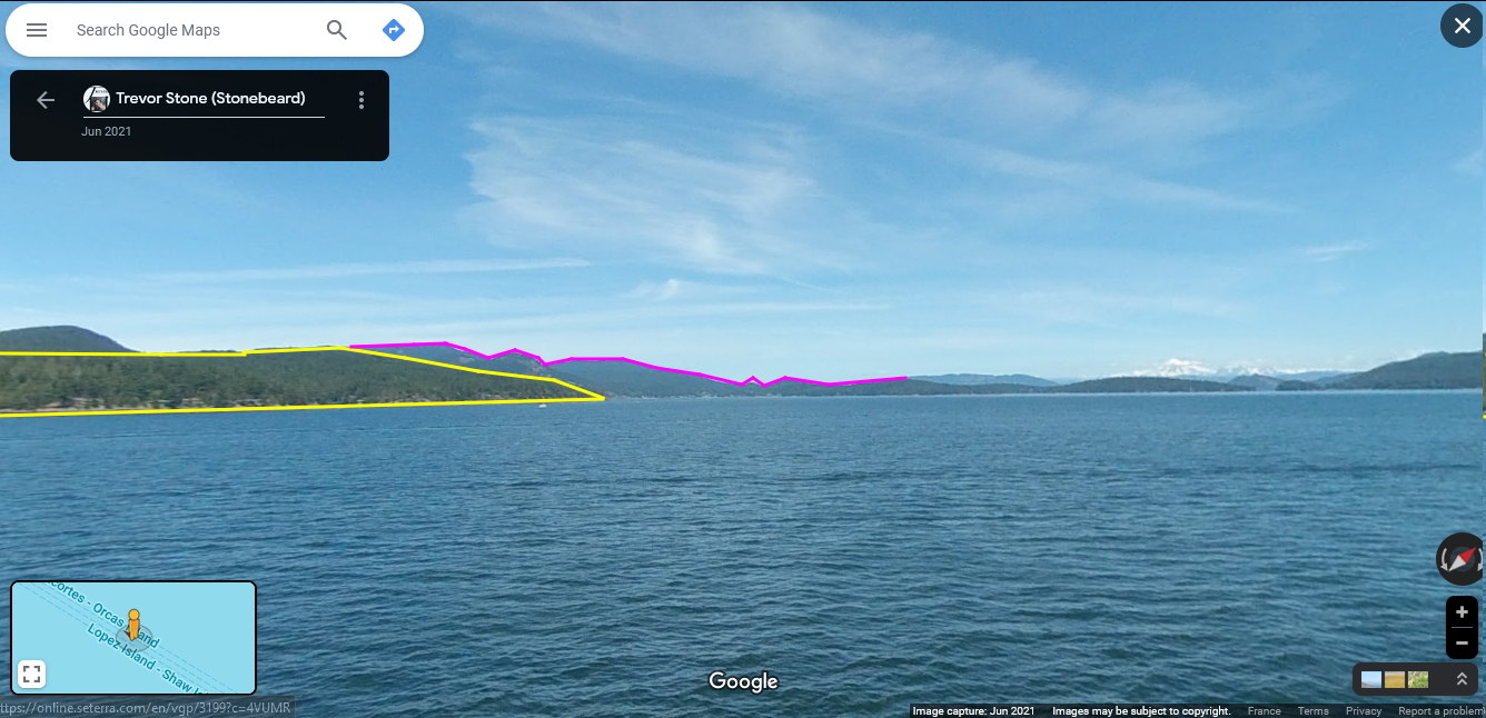
Maybe this is not clear enough for you when I put all of these lines on the images but let’s compare the elements that made me think this was the correct location:

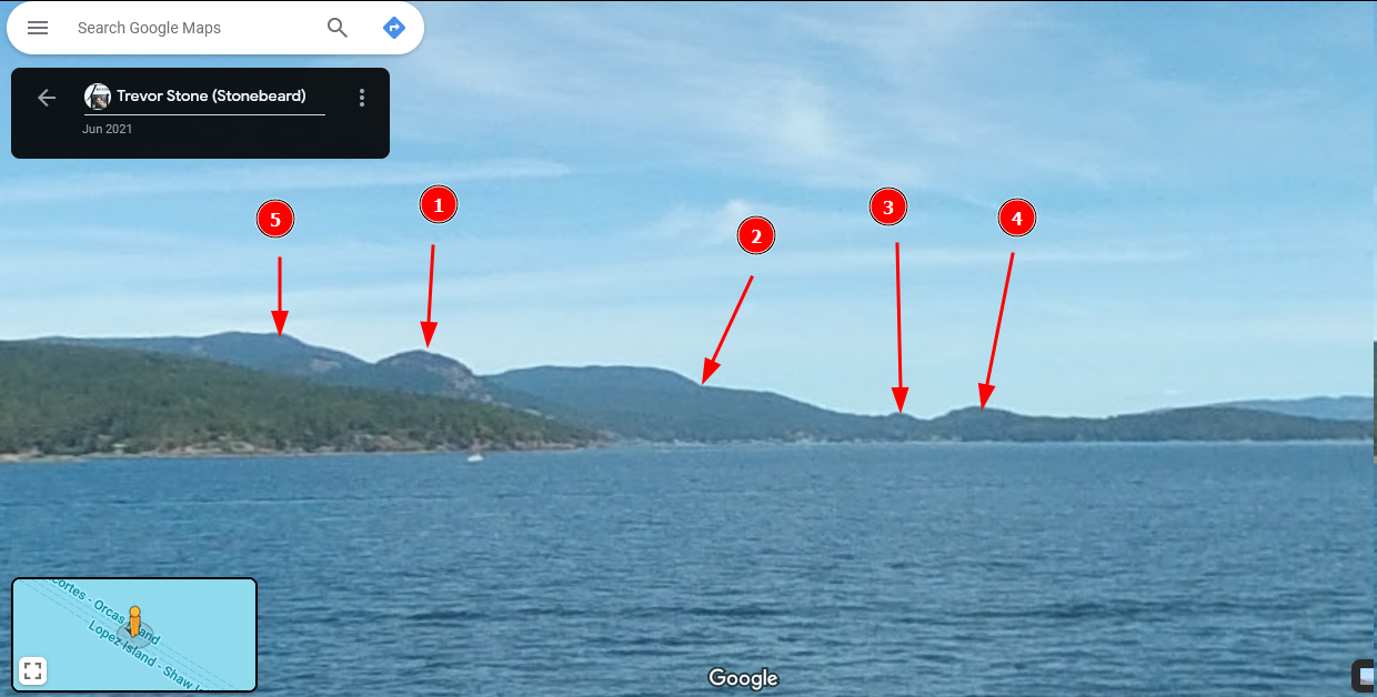
From now, I decided to play with Google Earth to help me with the 3D view to identify the hills and mountains around.
After some time, I eventually found this interesting point of view:
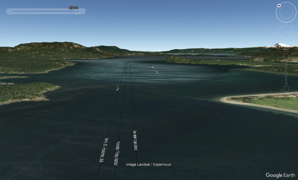
It almost confirms the location.
But let’s see where it is using Google Maps:
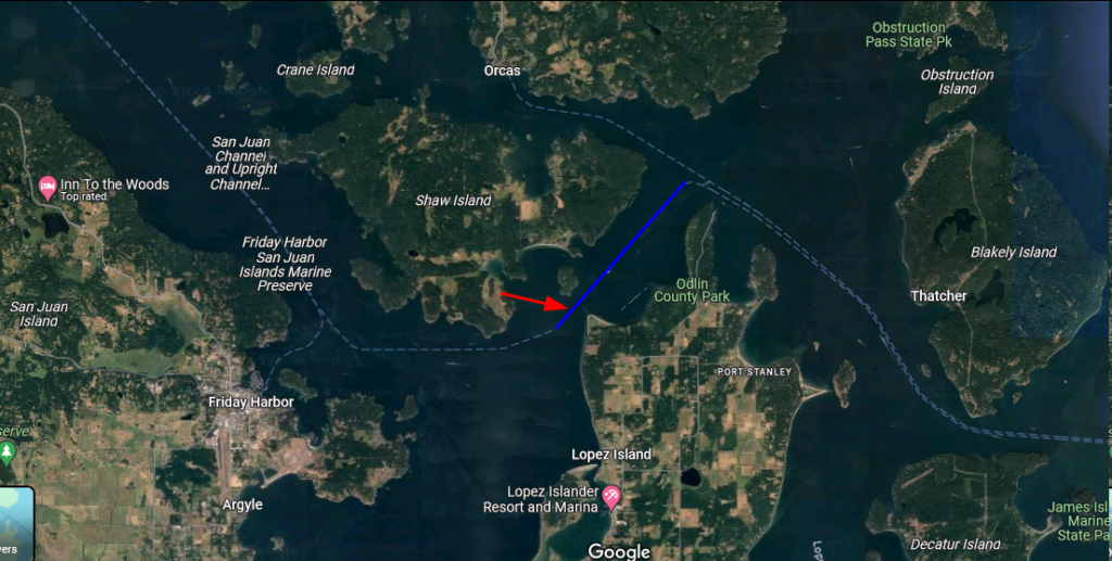
The ferry is going north.
Unfortunalety there’s no Street View on a ferry to validate the location but I found this point on a coast which allows us to see what we want:
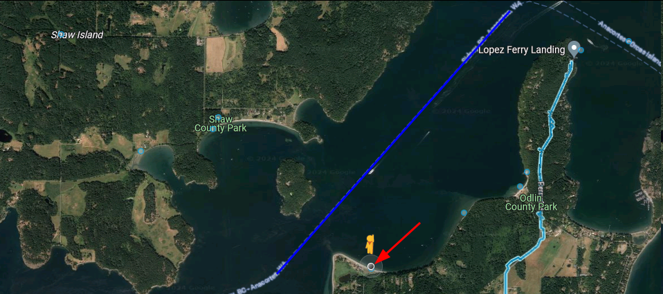
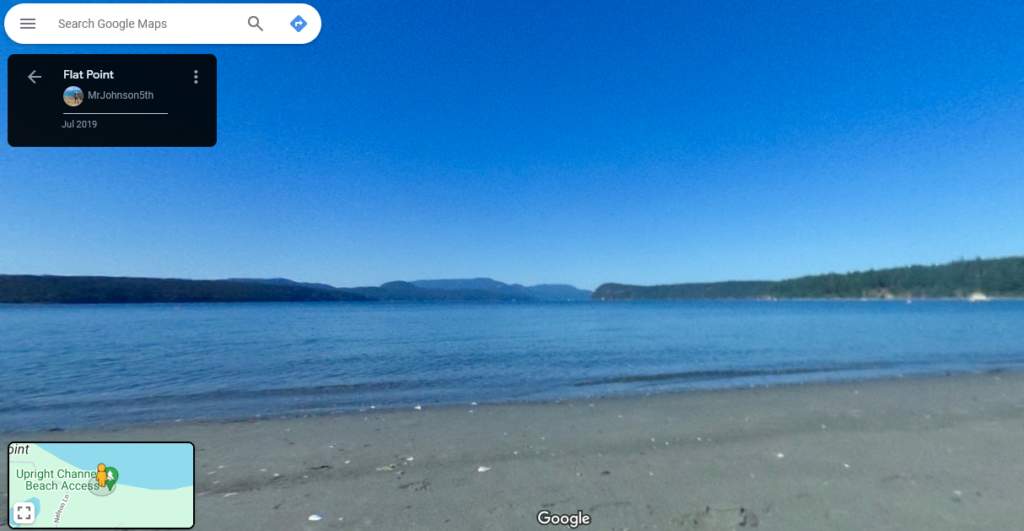
https://www.google.com/maps/@48.54948,-122.91425,3a,60.6y,28.01h,94.73t/data=!3m8!1e1!3m6!1sAF1QipMxk4huioaJgHKZPNAhDjAgZ68HkbaEHNDtu5zI!2e10!3e11!6shttps:%2F%2Flh5.googleusercontent.com%2Fp%2FAF1QipMxk4huioaJgHKZPNAhDjAgZ68HkbaEHNDtu5zI%3Dw203-h100-k-no-pi-10-ya15.839994-ro-0-fo100!7i5376!8i2688?entry=ttu
The landscape is recognizable and we’re able to finally validate the exact position where the video was recorded.
Hope you enjoyed the writeup and that you learnt some new techniques.
Do not hesitate to contact me if you want to discuss about OSINT/GEOINT or if I made a mistake or missed a crucial piece of information.
Answer
GPS Coordinates: Around 48.549834, -122.927072
