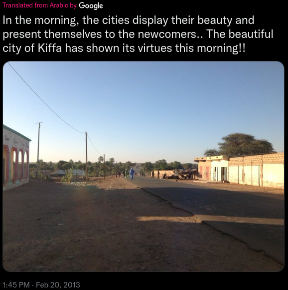
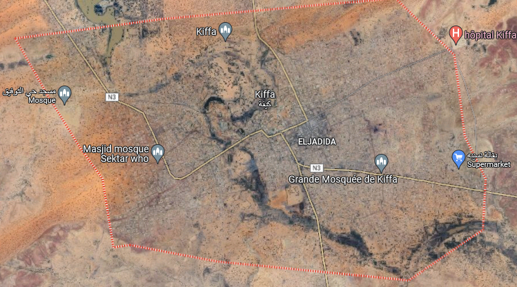
First post about the challenges made by Sofia Santos.
Hope you’ll learn new things with me
Introduction
Link: https://gralhix.com/list-of-osint-exercises/osint-exercise-001/
Difficulty:
For beginners: Hard
For experts: Medium
Briefing:
Below you can see a screenshot from a tweet containing a photo. It contains
all the relevant information necessary to help you find the exact location.
Please identify the coordinates of where the photo was taken.

Click [here](https://gralhix.files.wordpress.com/2023/01/osintexercise001.jpeg) for the photo without the Twitter border.Solution
Before trying to find the location, let’s focus on the context.
The photo comes from a tweet that is written in arabic language but has been automatically translated by Google Translate.
So it could be a photo from an arabic country.
This is the morning as specified in the tweet (even if the photo was posted at 1:45 PM).
And we know the city: Kiffa
I tried to retrieve the original tweet but I failed. Either I’m not good enough (probably) or the tweet has been deleted.
We know that the sun always rises in the east. In the photo, the sun is on the left so the road we see goes to the south.
It looks like it is at the southern city’s border. This is a very interesting observation because we can already focus on specific area of the city.
Their are not a lot of attributes in this photo to help us get the location so we’ll need to focus on specific clues such as position of houses, trees, form of the roads, etc…
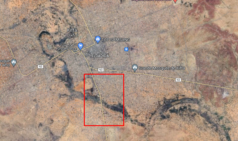
We retrieve a few basic information about the location of the city by using Google Maps:
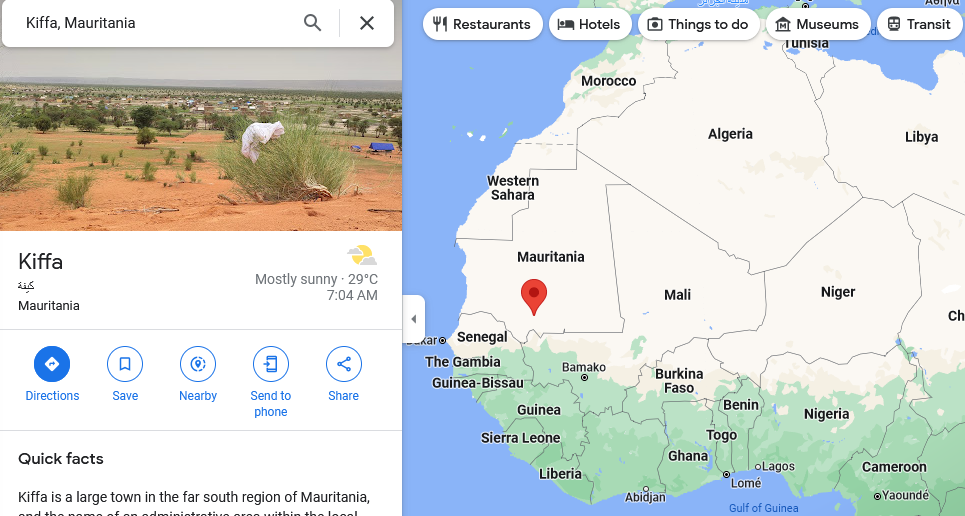
There are only three pinpoints related to Street View in the city and for all of them we can’t move.
The interesting one is the following:
https://www.google.com/maps/@16.6155556,-11.3911667,3a,75y,111.33h,87.05t/data=!3m8!1e1!3m6!1sAF1QipNGKO-3KGfB6jjW6JuU9v2cQJYVuLkwa0AGCTj7!2e10!3e11!6shttps:%2F%2Flh5.googleusercontent.com%2Fp%2FAF1QipNGKO-3KGfB6jjW6JuU9v2cQJYVuLkwa0AGCTj7%3Dw203-h100-k-no-pi6.438964-ya349.8158-ro-1.8766094-fo100!7i3584!8i1792?entry=ttu
Houses look the same as in the photo. So it confirms we are in the correct city (it is the only town with this name in the world).
Only one road is going to the south with vegetation:
I tried to use another satellite view than Google Maps because it could reveal other clues:
https://satellites.pro/Mauritania_map#16.608911,-11.397610,19
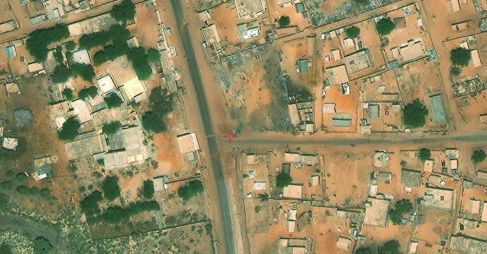
The area could match our photo.
Then, I used Google Earth to change the point of view and get closer to see if any of the elements in the photo are matching the ones from satellite images:
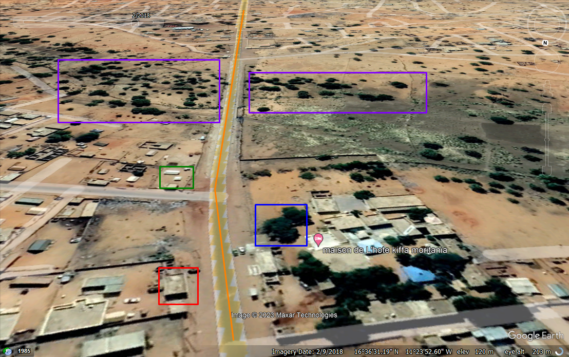
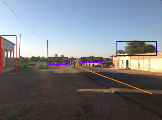
The road (orange) has the same form, the tree (blue) corresponds to the location.
There’s a lot of vegetation in the front of the image (purple).
We can identify a building with sheet metal on top (green).
And finally the building near to us, where the photo has been taken.
I didn’t mention it but the two shadows on the road confirm there are two buildings close to each other.
It matches with the satellite view.
All these elements confirm the geolocation of the photo.
Thanks to @Gralhix for the challenge, it was very funny!
Flag
16.609407,-11.397771,19

